Blog

  • Udawalawe National Park

    Udawalawe National Park

    Udawalawe National Park

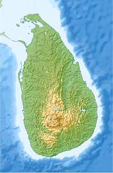
    Udawalawe National Park lies on the boundary of Sabaragamuwa and Uva Provinces, in Sri Lanka. The national park was created to provide a sanctuary for wild animals displaced by the construction of the Udawalawe Reservoir on the Walawe River, as well as to protect the catchment of the reservoir.

    The reserve covers 30,821 hectares (119.00 sq mi) of land area and was established on 30 June 1972. Before the designation of the national park, the area was used for shifting cultivation (chena farming). The farmers were gradually removed once the national park was declared. The park is 165 kilometres (103 mi) from Colombo. Udawalawe is an important habitat for water birds and Sri Lankan elephants. It is a popular tourist destination and the third most visited park in the country.

    Physical features

    Udawalawe lies on the boundary of Sri Lanka’s wet and dry zones. Plains dominate the topography, though there are also some mountainous areas. The Kalthota Range and Diyawini Falls are in the north of the park and the outcrops of Bambaragala and Reminikotha lie within it. The park has an annual rainfall of 1,500 millimetres (59 in), most of which falls during the months of October to January and March to May. The average annual temperature is about 27–28 °C (81–82 °F), while relative humidity varies from 70% to 82%. Well-drained reddish-brown soil is the predominant soil type, with poorly drained low humic grey soils found in the valley bottoms. Mainly alluvial soils form the beds of the water cources.

    Udawalawe National Park

    Ecology Udawalawe National Park

    The habitat surrounding at the reservoir includes marshes, the Walawe river and its tributaries, forests and grasslands.[2] Dead trees standing in the reservoir are visual reminders of the extent of forest cover before the construction of the Udawalawe Dam. Green algae, including Pediastrum and Scenedesmus spp., and blue green algae species such as Microsystis, occur in the reservoir. Areas of open grassland are abundant as a result of former chena farming practices. There is a plantation of teak beyond the southern boundary, below the dam, which was planted before the declaration of the park. Species recorded from the park include 94 plants, 21 fish, 12 amphibians, 33 reptiles, 184 birds (33 of which are migratory), and 43 mammals. Additionally 135 species of butterflies are among the invertebrates found in Udawalawe.

    Flora

    Hopea cordifolia, Memecylon petiolatum, Erythroxylon zeylanicum, and Jasminum angustifolium are endemic floral species recorded from the park. Hopea cordifolia is found along the river along with Terminalia arjuna. Panicum maximum and Imperata cylindrica are important food sources for the elephants. Chloroxylon swietenia, Berrya cordifolia, Diospyros ebenum, Adina cordifolia, Vitex pinnata, Schleichera oleosa, and Diospyros ovalifolia are the common taller trees. Terminalia bellirica and Phyllanthus emblica are plants of medicinal value found in the forest. Cymbopogon confertiflorus grass species and Grewia tiliifolia bushes are common in the grasslands.
    Fauna

    Udawalawe National Park

    Mammals

    The park is capable of sustaining a large herd of Sri Lankan elephants

    Udawalawe is an important habitat for Sri Lankan elephants, which are relatively hard to see in its open habitats. Many elephants are attracted to the park because of the Udawalawe reservoir, with a herd of about 250 believed to be permanently resident. The Udawalawe Elephant Transit Home was established in 1995 for the purpose of looking after abandoned elephant calves within the park. A total of nine calves, on two occasions in 1998 and 2000, with another eight calves in 2002, were released in the park when old enough to fend for themselves.

    The rusty-spotted cat, fishing cat and Sri Lankan leopard are members of the family Felidae present in Udawalawe. The Sri Lankan sloth bear is seldom seen because of its rarity. Sri Lankan sambar deer, Sri Lankan axis deer, Indian muntjac, Sri Lankan spotted chevrotain, wild boar and water buffalo are among other mammal species. Golden jackal, Asian palm civet, toque macaque, tufted grey langur and Indian hare also inhabit the park. A study conducted in 1989 found that considerable numbers of golden palm civets inhabit the forests of Udawalawe. Five species of mice also have been recorded from the park. The endemic Ceylon spiny mouse, known from Yala National Park, was recorded in Udawalawe in 1989. Indian bush rat and three species of mongoose are also recorded in the national park.

    Udawalawe National Park

    Birds

    Udawalawe is also a good birdwatching site. Endemics such as Sri Lanka spurfowl, red-faced malkoha, Sri Lanka grey hornbill, brown-capped babbler, and Sri Lanka junglefowl are among of the breeding resident birds. White wagtail and black-capped kingfisher are rare migrants. A variety of water birds visit the reservoir, including cormorants, the spot-billed pelican, Asian openbill, painted stork, black-headed ibis and Eurasian spoonbill.

    The open parkland attracts birds of prey such as white-bellied sea eagle, crested serpent-eagle, grey-headed fish eagle, booted eagle, and changeable hawk-eagle. Landbirds are in abundance, and include Indian roller, Indian peafowl, Malabar pied hornbill and pied cuckoo.
    Reptiles and fish

    Oriental garden lizards, painted-lip lizards, mugger crocodiles, Asian water monitors, Bengal monitors and 30 species of snake are found in the park. Garra ceylonensis is an endemic fish species recorded in park. Introduced Oreochromis spp., giant gourami, catla, and rohu are important food fish species found in the reservoir.

    Udawalawe National Park

    Conservation

    Clearing natural forests and planting monospecies cultures such as pine and eucalyptus are causing reduced water levels in the Walawe river. Encroachment by human settlements, poaching, illegal logging, gem mining, overgrazing and chena farming are major threats to the park. Lantana camara and Phyllanthus polyphyllus are invasive weeds affecting the food plants of the elephants. Occasions of elephants being shot with illegal muzzleloader guns has been reported.

    Tourism

    In the six months ending in August 2009, the park earned revenue of Rs. 18.2 millions.[5] From 1994 to 2001 some 423,000 people visited the park, 20% of them foreigners. For the 1998-2001 period average annual revenue was US$280,000. Postage stamps bearing the images of four wild animals of Udawalawe were issued on 31 October 2007 in the series “National Parks of Sri Lanka”,[6] featuring water buffalo, Sri Lankan elephant, ruddy mongoose and tufted grey langur.


    Udawalawe National Park (2) Udawalawe National Park 3 Udawalawe National Park 4 Udawalawe National Park Udawalawe National Park_map Udawalawe

  • Good things to see and do in Sri Lanka

    There are many great things to see and do in Sri Lanka.

  • Kalutara Sri Lanka

    Kalutara Sri Lanka

    Kalutara (Sinhalese: කළුතර, Tamil: களுத்துறை) or Kalutota is a large town inKalutara District, Western Province, Sri Lanka.

    It is also the administrative capital ofKalutara District. It is located approximately 40 km (25 mi) south of the capital Colombo.

    Once an important spice-trading center, the town’s name is derived from the Kalu Ganga River (‘Black River’ in native Sinhala). In the 11th Century, the town was temporarily made a capital on the orders of a South Indian Prince. The region was later planted with coconut trees, whose by-products are used for both internal and external trade. The location also boast fortifications (Kalutara fort) dating back from the times when Portuguese, Dutch and British vied for control of the area.
    The 38 m (125 ft) long Kalutara Bridge was built at the mouth of the Kalu Ganga River and serves as a major link between the country’s western and southern border.

    Kalutara District is located in the south west of Sri Lanka and has an area of 1,598 square kilometres (617 sq mi).

    Kalutara or Gangatilaka Vihara built in the 1960s to the south of the Kalutara Bridge, is Kalutara’s most dominant landmark. The white 3 storeys-high dagoba at Kalutara Vihara is believed to be the only Buddha Stupa in the world which is entirely hollow. It contains a smaller dagoba inside. The interior of the Stupa is decorated with paintings of the Jataka tales about the life of the Buddha.

    Kalutara Bodhiya is one of the most famous sacred and devotional Buddha Buddhist sites in Sri Lanka. It is one of the 32 saplings of Anuradhapura Sri Maha Bodiya.
    Kalutara Bodiya is located on Colombo-Galle road.

    Richmond Castle a two storey mansion, built in 1896, at Palatota. Richmond Castle is a 42-acre fruit garden estate, originally built for a wealthy regional governor. The architecture is a mix of British and Indian styles, copied from the plans of an Indian Maharaja’s palace designed by a London architect. The entire building is characterized by intricate carvings.

    Calido beach is a popular beach among tourists due to its natural beauty and scenic views. It is a thin strip of preserved land which runs between the Kalu River and the Indian Ocean.

    Kalutara Beach is one of country’s finest beaches. It is only one hour drive from Colombo

    Asokaramaya Buddhist Temple a historic Buddhist temple built in 1873, in Kalutara north

    Rail
    Kalutara has two railway stations, Kalutara North and Kalutara South. Kalutara South, however, is the one closest to the heart of the Kalutara town. Kalutara south railway station is a major railway hub on the Coastal or Southern Rail Line (connecting Colombo through to Matara).

    Road
    Kalutara is located on the A2 highway connecting Colombo, via Galle through to Wellawaya via Matara. As a result a large number of bus services pass through the town. It is the main point for bus routes in Kalutara district.

  • Ravi Retreat Dodanduwa Sri Lanka

    Ravi Retreat Dodanduwa Sri Lanka

    The Ravi Retreat is situated in a tranquil location by the lake and adjacent to the sea and tropical beach of Dodanduwa.

    The estate is managed by the owner Captain Ravi who gained his hospitality experience working as head of watersports at Emirates Palace Hotel in Abu Dhabi and Captain of various super yachts based around the famous Abu Dhabi F1 race track at Yas Marina in the United Arab Emirates.

    Retiring to his family home in Dodanduwa Sri Lanka he now runs a quiet retreat where guests can enjoy the natural environment that few guests are lucky enough to experience – all are welcome, however this a natural place and is not for the party and disco seekers!

    Captain Ravi is a fully licenced PADI Dive Master and can arrange some splendid dives around his home and coastline.

    There are many jungle treks around his estate and he is happy to guide you on an adventurous but safe walk where you can see all the rewards that the tropical jungle offers.

    Accommodation is at his house where a separate self contained apartment is fully stocked with modern conveniences.

    If you wish to go on day tours and see what else Sri Lanka has to offer – this is an ideal location to be based.

  • Sri Lanka FAQ what you need to know

    Sri Lanka FAQ what you need to know

    Sri Lanka FAQ what you need to know

    Here is our Sri Lanka FAQ what you need to know to get the most out of your trip when visiting and travelling around Sri Lanka

    So where exactly is Sri Lanka, is it an island?

    Sri Lanka is a beautiful tropical island in the South-east region of Asia. It is the teardrop shaped island in asia and has India just to the North. Sri Lanka has latitudes between 5° 55 and 9° 55 North and the eastern longitudes are between 79° 42. and 81° 52. Sri Lanka is 650km north of the equator.

    How big is the island of Sri Lanka?

    25,299 Sq. miles (65,525 square kilometres). The longest length is between the lighthouse at Dondra Head in the south to Point Pedro in the north is 271 miles (435km) while the greatest width is 149 miles (240km)

    Sri Lanka FAQ
    Sri Lanka FAQ what you need to know to get the most out of your trip when visiting and travelling around Sri Lanka

    Is Sri Lanka worth a visit and why?

    Without doubt you should visit Sri Lanka! You will soon see for yourself that Sri Lanka is probably one of the greatest places to visit because of the many adventures that you can experience in one island, where everything is less than a day travel away. Each journey is it ‘self an adventure and breath taking views abound. Sri Lanka has been listed as one the best places to travel by both National Geographic.

    When is the best time of year to visit Sri Lanka?

    Being a tropical country, Sri Lanka has pretty much the same kind of weather season all year apart from the monsoon seasons which have awesome rain storms, otherwise there are showers throughout the year which give a warm sunny climate and make the island so green and beautiful.

    rainfall down south sri lanka

    What are the attractions of Sri Lanka?

    Sri Lanka is one of the greatest places on earth where you can indulge in a huge selection of experiences and sample various lifestyles. The weather is warm and comfortable and yet still varied from the mountains of Kandy to the golden beaches of “down south”, You will see some of the most scenic countryside in the world. Sri Lanka has a diverse and vibrant culture, with friendly people. You can partake in adventurous sports and tours that will give memories for life. You can just chill out on the beach or colonial style mansion hotel – all up to you

    What kind of clothes should I wear?

    Your attire usually depends on where you are. Religious places have a strict dress code where you are expected to show respect. Otherwise, casual or smart, wear almost anything that goes with the warm climate , sundresses, shorts , t-shirts and sandals – just remember to protect yourself from the awesome weather and sun.

    What ancient sites should I visit?

    There are loads of archaeological sites, ancient ruins, nature reserves, beaches and plenty more. UNESCO has named many places in Sri Lanka as World Heritage Sites such as Sigiriya, Anuradhapura and Polonnaruwa.

    Where should I stay in Sri Lanka?

    In Sri Lanka you can find accommodation options from five-star hotels, motels, resorts, bungalows and villas, guest houses and many more places. Check out our listings – remember – we only list what we have seen – to ensure that yo only have good surprises.

    Is Ayurvedic medicine available?

    Sri Lanka is proud of an ancient medicinal system that can be used by just about everyone. You can experience Ayurvedic treatments at the many spas as well as Ayurvedic hospitals.

    What is the Sri Lanka international dialing (IDD) code?

    The IDD code is +94

    What is the voltage type in Sri Lanka?

    Sri Lanka’s electricity runs at 230-240V, 50 cycles AC – British standard, however the plug sockets are three pin round type – you can get adaptors in most supermarkets.

    What languages are spoken in Sri Lanka?

    English is widely spoken in the tourist and business areas. Sinhala is the most used official language. With Tamil used by some the population especially in the North, Tamil is also an official language in Sri Lanka.

    What currency is used in Sri Lanka?

    Sri Lankan Rupee (LKR) Accommodation starts at around LKR5,000 for simple and clean guest houses and as much as you want to pay for extravagance 🙂

  • Kirinda Sri Lanka

    Kirinda in on the South East coast of Sri Lanka is a small but beautiful village on the southern coast of Sri Lanka close to Kataragama.

    The area is also close to the Great and small Basses reefs which provide some of the most spectacular scuba diving and fishing in the Sri Lanka.

    There is a rock-strewn outcrop from which can be obtained some glorious views of the desolate coast with its long stretch of sand dunes. Kirinda was used as a land base by Arthur C. Clarke’s party when diving for the Great Basses wreck (Treasures of the Reef).

    One of the most famous attractions in Kirinda is the statue of Queen Viharamaha Devi. This is located on the spot where she is said to have landed after being set adrift on the sea from Kelaniya. The rock temple mentioned above is largely believed to be the site of her landing.

    There are eco-friendly beach resorts situated in Kirinda, in an area famous for its diversity of wildlife. Kirinda is conveniently and centrally located to right to use both major wild life parks of Yala and Bundala. There are some wonderful beachs in Kirinda.

    Kirinda is infamous for its wealth of wildlife diversity and superb beaches located on the magnificent stretch of beautiful coastline.

    Activities

    From the resorts visitors are free to explore their adventurous spirit by engaging in activities they would not normally be exposed to.

    Interesting activities that can be arranged include special excursion trips to experience rural village life or to do fishing in traditional boats using traditional methods or deep sea sports fishing on catch and release concept.

    Safari Trips

    Experience the excitement of encountering a variety of wildlife species ranging from the small and beautiful butterflies and birds to the large and charismatic mammals like Leopards, Bears and Elephants.

    The parks that are within reasonable traveling distance from the resort include Yala and Bundala National Parks, Lunugamvehera & Udawalawe Parks and also there are many bird sanctuary sites within close distance.They are Weerawila bird sanctuaty, Tissamaharama bird lake

    Dolphin Watching

    Guaranteed sightings cannot be expected in this region, unlike the professional tour operations conducted in Mirissa. Although dolphin’s are resident throughout the year in Kirinda the most suitable period is between December to April where sea conditions are more calm. Whales have been seen in this region over the same time period but guest may have to travel further out into deep ocean water to find them.

    Trips can be arranged in small local fishing boats from Kirinda Harbour located 1½ kms away from the resort.The dolphin watching trips depart at 6am and travel a distance of 12 To 15km in open ocean towards the coral reef and light house area. Trips lasts for about 5 hours duration, returning in time for lunch. The resort can arrange breakfast packs for any guests who wish to do this activity. You should be aware that these are local fishing boats with local fishermen, with limited English speaking skills and no safety equipment.

    Bird Watching

    This can be done in both national parks as well as the lesser known Lunugamwera National Park which is a forested habitat different to Yala & Bundala. Bundala Park is a RAMSAR wetland habitat which is a famous bird migratory site, especially from October to March. However, there are many bird viewing sanctuaries in the vicinity around the areas of Kirinda, Tissamaharama and Weerawila.

    Visitors can explore the area by vehicle, cycling or hiking around to discover the diversity of bird species to be found in these local areas containing a variety of habitat types.

    Turtle Watching

    Turtles are often seen close to the beach shore by the large rock boulders during the daytime. They can be seen coming up for breadth if you look to the water surface from the rocks close to the river. Turtles frequently come to lay eggs along this undisturbed coast land stretch. Some guests have been fortunate to see this incredible event and taken photographs of their encounter close to the beach.

    Sports Fishing (operated by Gamefishing)

    Fishing excursion trips can be arranged for guests who want to participate in deep sea sports fishing. This novel activity is conducted by professional fishing experts based in Kirinda Harbour. They operate their fishing principles on a catch & release basis. Gamefishing provides this activity in the Kirinda area from November to April but will be dependent on sea conditions. Gamefishing boats are equipped with all the safety and fishing equipment and they can carry a maximum of 4 people per boat.

    Gamefishing provides exclusive service to their clients and bookings can be made at www.gamefishingasia.com/destination-by-fishing-type/sri-lanka-kirinda/


  • Tangalle Sri Lanka

    Tangalle Sri Lanka

    Tangalle (Sinhala තංගල්ල [ˈtaŋɡalːə], Tamil: தங்கல்லை) (also known as Tangalla) is a large town in Hambantota District, Southern Province, Sri Lanka, governed by an Urban Council. It is one of the largest towns in southern province. It is located 195 km (121 mi) south of Colombo and 35 km (22 mi) east of Matara. It has a mild climate, in comparison to the rest of the district, and sandy beaches.

    The name of the town in Sinhala means “projected rock”, a reference to the rocks which form the coastline in the town area, which contrasts with the sandy beach of the surrounding areas. Another rationale is that the name is derived from ran-gala or “golden rock”, which relates to a local legend that a holy man once ate a meal there and the rock was turned to gold.

    Tangalle is a regionally important fishing port, situated on one of the largest bays in Sri Lanka, which is protected from the ocean by an enclosing reef. It is a centre of tourism and a popular holiday destination on the south coast. In the town centre there is an old Dutch fort which is used as a prison today. The Dutch and subsequently the British used Tangalle as an important anchorage on the southern coast of the island. The Dutch Fort, Rest House and Court House are a few remaining examples of Dutch architecture in Tangalle.

    Tangalla is the gateway to the wide-open spaces and wide-open beaches of southeast Sri Lanka. It’s the last town of any size before Hambantota and has some old world charm. But you’re really here to find your perfect beach and revel in it

    Tangalle is a lazy fishing town situated on one of the finest and largest bays of Sri Lanka. With a palm fringed bay, beautiful coves and vast golden beaches Tangalle is a tranquil alternative to the more vibrant tourist beach destinations. The popular bays here are Goyambooka, Medaketiya, Pallikkudawa and Medilla. Medaketiya is a beautiful quiet beach with fine white sand. The most popular tourist attraction in Tangalle is the stunning Mulkirigala rock temple. The best months to visit this scenic town is from November through April.

    Highlights of Tangalle

    Mulkirigala Rock Temple
    Dondra Point
    Bundala National Park
    Ussangoda National Park
    Kudawella Blow Hole – Hummanaya
    Turtle Watching at Rekawa

    Forget Bentota and Hikkaduwa. Sri Lanka’s deep south is the next big destination. Tangalle, on the southern coast (just three and a half hours from Colombo) is a small town with a bustling fishing port and is well known for its beautiful stretch of palm-fringed bays and coves. The name Tangalle means ‘projecting rock’, because long ago, the town was protected from the ocean by a long rocky slab that projected into the sea across the mouth of the bay. Here are eight ways to get acquainted with this lesser-explored region of Sri Lanka:

    Luxe out Tucked into a coconut grove and bordering an arc of pristine white sand beach, Amanwella resort has thirty luxurious suites built on three different levels, with private plunge pools and terraces overlooking the Indian Ocean. The Australian architect who designed the resort with local hand-hewn stone and terracotta roof tiles was inspired by the clean vertical lines of Geoffrey Bawa , Sri Lanka’s most famous architect. There is nothing that separates you from the sea: the Bar, restaurant, swimming pool and cosy library all look out over the turquoise sea and endless coconut groves. Have a massage at the spa here and tuck in to Mediterranean and Asian fusion cuisine as you sip on a local beer or two. (www.amanresorts.com)

    Cruise through the mangroves Tangalle has some beautiful lagoons and mangroves where you can go on a river safari or kayak and spot weaverbirds and monkeys in the trees, storks and cranes along the banks, and water monitors in the shallows. Plan to wrap up just before dusk if you can, to witness the amazing sight of thousands of fruit bats descending on the trees. When you’re done, get a snack at one of the many small restaurants on the nearby beaches.

    Tuck into local fare Tangalle is a great place to eat traditional Sri Lankan food like rice and piquant curries, hoppers made from fermented rice batter with a dash of palm toddy and coconut milk, sea food and the famous street-food favourite Kottu paratha, which is diced chapattis pounded with spices, meat and vegetables. Don’t forget to taste local specialties like fiery coconut sambol and drink sweet King Coconut water. Indulge your sweet tooth too, with local desserts like thick buffalo curds that are sold in mud pots with local treacle made from the sap of a palm tree called Kitul, and Watalappam—steamed custard made from coconut milk and palm sugar spiced with cinnamon and cloves.

    Visit the fishing harbour Tangalle once was a harbour for the Dutch and British fleets. Today it has a bustling fishing harbour (the first manmade one in Sri Lanka) where trawlers and boats land after days out at sea, with their swollen nets of fresh fish. Go early in the morning to see fish being auctioned, gutted and cut up.

    Laze on the beach Tangalle’s beaches are meant for lounging. You share the beach only with small fishing boats and a few fishermen mending nets. The turtle-trampled sands are great for walking and sunbathing. Tangalle’s deserted beaches are where the turtles lay their eggs in the golden sand. If you want to see giant sea turtles coming ashore at night (January to July) to lay their eggs, then the beach of Rekawa is ideal. Tangalle has some great stretches of beaches like Marakolliya and Medaketiya, which are dotted with tiny shacks selling freshly-cooked local fish and curry.

    Visit the Hoo Maniya blow hole Around seven kilometres from Tangalle, the village of Kudawala is home to the Hoo-maniya blowhole, whose name derived from the low, whistling sound it produces prior to spouting water. The blowhole is formed from a narrow fissure in the cliff, and is most impressive during the monsoon when the jets—churned to a dazzling whiteness—can go as high as 15m.

    See the stilt fishermen On the way to Tangalle, around Kogalla, you will see Sri Lanka’s famous stilt fishermen perched on a vertical pole planted into the sand, holding the stilt with one hand and a fishing rod in the other. They catch small fish like herring with just a crude fishing pole and a hook with no bait. Many say that this originated after the Second World War when the fishermen had to contend with rocky beaches and found this method a good way to fish inside the deep waters. Of course with it now becoming such a popular tourist attraction, many of the wily fishermen ask for money before letting you photograph them

    Attractions
    The Mulkirigala Raja Maha Vihara is ( also known as Mulkirigala Rock Temple) 20 km (12 mi) north of the town. The temple is perched on a boulder approximately 200 m (660 ft) high. According to ancient inscriptions carved on the rock, Mulkirigala dates back almost 2,000 years when it was a site of a Buddhist monastery. The temple complex consists of ancient murals, a recumbent Buddha statue, devalayas, and several cave temples all of which are found at different levels while ascending the peak of the rock. One of the caves houses a library in which, a most important discovery was made in 1826 by a British administrator, George Turnour, who found a number of olas (palm-leaf manuscripts) containing the key to translating the Mahawamsa, the ‘Great Chronicle of Sri Lanka’. Turnour’s discovery of the tika, or commentary, made it possible for the Mahawamsa to be translated from Pali first into English and then into Sinhala, this translation then enabled scholars to study the history of the island from 543BC to comparatively modern times.

    The Parewella Natural Swimming Area, is located 0.9 km (0.56 mi) from Tangalle town center.
    Hummanaya blowhole, is located 11.2 km (7.0 mi) north of the town in the fishing village of Kudawella. It is the only blowhole in Sri Lanka.[7]
    Kalametiya Bird Sanctuary is 24 km (15 mi) east of the town. The Kalametiya Bird Sanctuary was declared a wildlife sanctuary in 1938, originally with 2,500 hectares but was abolished in 1946 due to the opposition by local residents. It was once again declared a sanctuary in 1984 but with a considerably reduced area. The Kalametiya Bird Sanctuary is an area of coastal lagoons and mangroves,[8] which is rich in marine and home to four nationally threatened birds: Indian Reef Heron (Egretta gularis); Glossy Ibis (Plegadis falcinellus); Black-capped Purple Kingfisher (Halcyon pileata); Sri Lankan Junglefowl (Gallus lafayettii), as well as other birdlife and reptiles, a large number of which are nationally and globally threatened.
    Turtle Watch Rekawa is 10 km (6.2 mi) east of the town. At the beach you can watch five species of marine turtles: Green turtles, Loggerhead turtles, Leatherback turtles, Olive Ridley turtles and Hawksbill turtles laying their eggs in the sand nests at night. The Turtle Conservation Project that conducts a `turtle watch’ programme, which protects the nesting sites until the hatchlings return to the ocean.


  • Good Food Sri Lanka

    Good Food Sri Lanka

    How to Make Sri Lankan Egg Hoppers by Peter Kuruvita

    Good Food Sri Lanka

    Celebrity chef Peter Kuruvita shows you how to make one of Sri Lanka’s favourite foods – egg hoppers – Good Food Sri Lanka

    Using a simple base and explaining his technique, enjoy this ‘how to’ video that will have you making delicious egg hoppers at home in no time!

    Subscribe for more great videos and connect with Peter on social media.

    www.facebook.com/peterkuruvitachef
    www.twitter.com/peterkuruvita
    www.instagram.com/maldivefish

    And find more recipes on www.peterkuruvita.com


  • Hambantota Sri Lanka

    Hambantota (Sinhalese: හම්බන්තොට, Tamil: அம்பாந்தோட்டை) is the main town in Hambantota District, Southern Province, Sri Lanka.

    Hambantota Weather

    Hambantota features a tropical wet and dry climate. There is no true dry season, but there is significantly less rain from January–March and again from June–August. The heaviest rain falls in October and November. The city sees on average roughly 1,050 millimetres (41 in) of precipitation annually. Average temperatures in Hambantota change little throughout the year, ranging from 26.3 °C (79.3 °F) in January to 28.1 °C (82.6 °F) in April and May. This makes for lush green vegetation and exciting jungle.

    Hambantota Tourist Development

    Hambantota is undergoing a number of major tourist and commercial development projects including the construction of a new sea port and international airport. These projects and others such as Hambantota Cricket Stadium are said to form part of the government’s plan to transform Hambantota into the second major urban hub of Sri Lanka, after the capital of Sri Lanka, Colombo.

    Hambantota District is located close to several tourist attractions, including Arugam Bay, Nuwara Eliya and Yala National Park.

    Hambantota District has a population of 596,617 (2011) and is located at Lat 6°15′N Long 81°10′E

    Entertainment Island
    Sri Lanka has commenced construction of an exclusive entertainment island in the southern Hambantota coast and it will be constructed with rock and soil unearthed from the second phase of the construction of the seaport.The man-made island with an extent of about 48 hectares would be established in Hambantota in close proximity to the Magam Ruhunupura Mahinda Rajapaksa port. Several hotels, restaurants, duty-free shopping malls, recreational and tourism facilities are to be built.

    Convention Centre
    Magam Ruhunupura International Conference Hall (MRICH), located at Siribopura, was opened by President Mahinda Rajapaksa in November,2013.The MRICH situated in a 28-acre plot of land in Siribopura, Hambantota is Sri Lanka’s second international conference hall.The main hall has 1,500 seats and there are three additional halls with a seating capacity of 250 each. The conference hall is fully equipped with modern technical facilities and a vehicle park for 400 vehicles and also has a helipad for helicopter landing.The conference hall was constructed by the Urban Development Authority and the Korean international Corporation at a cost of US$15.3 million. The Commonwealth Youth Forum (CYF) that was held from November 10–14, 2013 was the first international conference held at the venue.

    Mattala Airport

    Mattala Rajapaksa International Airport (MRIA) (IATA: HRI, ICAO: VCRI) is an international airport serving southeast Sri Lanka. It is located in the town of Mattala, 18 km (11 mi) from Hambantota. Mattala Rajapaksa International Airport (MRIA) is located in the town of Mattala, 18 km (11 mi) north of Hambantota. Opened in March 2013, it is the second international airport in Sri Lanka after Bandaranaike International Airport in Colombo. flydubai and Rotana Jet fly from MRIA to Dubai and Abu Dhabi in the United Arab Emirates.

    Hambantota Transport

    The A2 highway connects Colombo with Hambantota town through Galle and Matara.
    In support of the new harbour, construction work started in 2006 on the Matara-Kataragama Railway Line project, a broad gauge railway being implemented at an estimated cost of $91 million.
    The Southern Expressway from Kottawa to Matara will be connected to Hambantota via Beliatta.

    Hambantota Sports

    The Mahinda Rajapaksa International Stadium, with a capacity of 35,000 seats, was built for the 2011 Cricket World Cup. The cost of this project is an estimated Rs. 900 million (US$7.86m). It’s located in a beautiful location.

    Hambantota Tele-cinema village

    A new tele-cinema village is being constructed at Ranmihitenna. It consists of three stages and will be constructed at a cost of 2 billion rupees. The first stage, opened on 30 March 2010 at a cost of 600 million rupees consists of an administration building, accommodation hall (with facilities for 96 individuals), a large studio, 31 sets, three showrooms for costumes, two seminar halls, two libraries, kitchens, back lots, workshops and common facilities.


    Ancient Hambantota

    Hambantota District is part of the traditional south known as Ruhuna. In ancient times this region, especially Hambantota and the neighboring areas was the centre of a flourishing civilization. Historical evidence reveals that the region in that era was blessed with fertile fields and a stupendous irrigation network. Hambantota was known by many names ‘Mahagama’, ‘Ruhuna’ and ‘Dolos dahas rata’.

    About 200 BC, the first Kingdom of Sri Lanka was flourishing in the north central region of Anuradhapura.

    After a personal dispute with his brother, King Devanampiyatissa of Anuradhapura, King Mahanaga established the Kingdom of Ruhuna in the south of the island. This region played a vital role in building the nation as well as nurturing the Sri Lankan Buddhist culture. Close to Hambantota, the large temple of Tissamaharama was built to house a sacred tooth relic.

    Around the years of 1801 and 1803, the British built a Martello tower on the tip of the rocky headland alongside the lighthouse overlooking the sea at Hambantota. The builder was a Captain Goper, who built the tower on the site of an earlier Dutch earthen fort. The tower was restored in 1999, and in the past, formed part of an office of the Hambantota Kachcheri where the Land Registry branch was housed. Today it houses a fisheries museum.

    From 2 August to 9 September 1803, an Ensign J. Prendergast of the regiment of Ceylon native infantry was in command of the British colony at Hambantota during a Kandian attack that he was able to repel with the assistance of the snow ship Minerva. Earlier, HMS Wilhelmina had touched there and left off eight men from the Royal Artillery to reinforce him. This detachment participated in Prendergast’s successful defense of the colony.If the tower at Hambantota was at all involved in repelling any attack this would be one of the only cases in which a British Martello tower had been involved in combat.

    Hambantota District is located on the southeastern coast of Sri Lanka. It has an area of 2,593 km² and a very dry climate. The district capital is Hambantota town; the administrative headquarters are there as well as the center of salt production. Other prominent towns include Tangalle, Ambalantota, Tissamaharama, and Beliatta.